Archaeological discoveries at Sherford
A talk by Stephen Reed
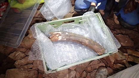
Mammoth tusk, courtesy of AC Archaeology
Construction on the new 5,500 homes town of Sherford started in 2015, on farmland to the east of Plymouth. Archaeologists were involved early in the process conducting geo-physical surveys looking for anomalies in the landscape such as ditches, pits and walls. Stephen’s talk took us through the amazing discoveries that have been made since.
Early finds after soil were stripped were of late Mesolithic hunter-gatherer flint tools and Neolithic pottery bowls with decorations made with bird feathers. Numerous post holes suggested Bronze Age roundhouses and rare examples of large earthen barrows yielded cremation cemeteries. A large pile of stones when cleared revealed a kistvaen (burial chamber) with an upturned urn and found to contain human bones and a copper knife. After expert analysis these were thought to be from a Bronze Age man aged between 35-45 with disc degeneration.
Maps created by the surveys showed a well-made but disappearing trackway, covered with shale dug out from old side quarries, a possible Roman road – maybe a military supply route. Ancient stone querns used for grinding grain were also found. A wet area contained burnt stone in the shape of troughs. It;s thought that these were for heating water though their purpose could be for cooking, washing clothes and textiles, brewing, rituals, or even ancient saunas.
In 2022 came the most important and astonishing discoveries for perhaps a century or more. In an area of limestone, the developers were drilling and pumping in concrete as foundations for the next set of houses. A subsequent sinkhole revealed an underground cavern which brought work to a halt. The subsequent excavations revealed over 200 clusters of extinct megafauna bones dating back to the last Ice Age 35-60,000 years ago. They include woolly mammoth, woolly rhinoceros, wolf, hyena, horse, reindeer, mountain hare and red fox, as well as bats and shrews. It is thought that some of the creatures fell into a pit and were unable to escape, and carnivorous scavengers followed and met a similar fate – or the animals died elsewhere and the bones washed into the area over a period of time.
The archaeological team have carried out environmental sampling and removed the bones for detailed analysis and recording. It is hoped that the bones will eventually be displayed in the Plymouth Box Museum.
The underground space has been conserved; no construction will take place on top of it. though the entrance will be closed to protect the historic site and ensure public safety. Stephen’s hopes were that perhaps eventually some suitable memorial and information space could be made available near the site. More information can be found on the Box website – www.theboxplymouth.com
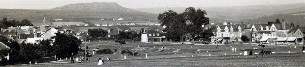
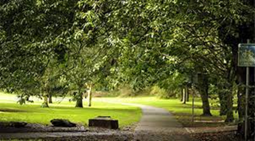
Central Park Plymouth: episodes from the past
A talk by Andrew Young
Andrew broke his talk down into 4 main periods of its history. Firstly, the Early Years 1925-39: Given Plymouth’s poor image on healthy living in the late 1920’s, the City Council decided that health was priceless and embarked on the purchase of what was mainly farmland for leisure activities for an expanding population. This included the impressive residence of Pound House and its grounds. Thomas H Mawson was appointed as the landscape architect who was one of the most influential designers of his time. The park was officially opened in 1931 and early facilities included tennis courts, a model boats pond, bowling green, cricket and children’s playground. Avenues of trees were planted.
As WW2 broke out, large parts of the park were given over to food growing with allotments, as part of the “Dig for Victory” campaign. Air raid shelters were built, ARP HQ set up at Pounds House, an emergency food station and gun emplacements constructed. Troops were billeted there in Nissen huts. Even a POW camp was established continuing in use until 1948 when many prisoners were employed in house building. Prefabs were built in the area.
By 1960 activities were resuming, though without real purpose. A zoo had opened in 1952 and had attracted over 100k visitors in its first 4 months. This closed in 1978 and was reopened as a skateboard park, closing again in 1981. A pitch-and-putt golf course, new indoor swimming pool and in 1970, the Mayflower leisure centre opened with facilities including a sports hall and squash courts. Plymouth Argyle football club levelled areas to make new football pitches. Car parks and access road layouts were changed. However, these developments were controversial because of the loss of green space,
The park was not popular during the start of the 21st century with run down facilities, vandalism and increased crime. Small steps were taken however with new playgrounds and a family tree planting scheme. In 2012, the Life Centre opened, replacing the former swimming pool and Mayflower leisure centre and leading to better use of space in the area. In 2017 a £9m improvement plan has led to an extension of the public skateboard park and bowling pavilion, new tennis courts, cafe, adventure playgrounds and ponds. In 2019 the park achieved its first Green Flag award.
Attention now is expected to be focussed on Pounds House, previously used as a social and cultural centre, Town Clerk offices, library, and cafe, it has been in “care and maintenance” since 2018.
Another excellent talk. More information can be found on the website Friends of Central Park Plymouth (focpp.org.uk)
“The Hated Cage” (a talk by Nick Guyatt)
Technical problems with the audio equipment meant no slideshow images, but Nick kept the audience enthralled with his entertaining talk, based on his book of the same name. He explained how Dartmoor prison had been built in 1809 to hold French PoWs from the Napoleonic wars and that it was also home to 6,500 American prisoners during the 1812 war.
Dartmoor prison was meant to be temporary but was built from granite as in 1806 all Britain’s timber went to the Royal Navy. The layout had 7 long blocks with 3 floors in each. There were no cells; prisoners were confined to their own block each night but were allowed to wander around the prison during the day. As they weren’t criminals they were allowed a certain amount of freedom as long as they didn’t try to escape. The PoWs were allowed to keep any money they had when captured; the better off could ask their relative to send more and each prisoner received an allowance from the US government. They had plenty of scope for commerce, gambling and an entire service industry within the prison.
The Americans taught each other boxing, dancing, fencing, foreign languages and more. The British allowed local traders to enter the prison every morning to sell or smuggle food, tobacco and other contraband items. The Americans acquired newspapers, alcohol and shivs (small pointed or bladed weapons). The prisoners also tried to escape by bribing the guards or by scaling the walls or digging tunnels.
With no end to the war and their release in sight, tensions grew; the suspicions, the accusations, the beatings that scarred them as their plight became more desperate. After a few months in Dartmoor the white Americans asked to be separated from the Black prisoners which was granted. The Black prisoners were given a separate block but the white men visited its shops, schools, church and theatre. The leaders of the white prisoner community had insisted to the British that they couldn’t live alongside Black people but rank and file white prisoners proved that the opposite was true.
Even when the war ended, release was not immediate leading to more anger and frustration at being incarcerated. In April 1815, during an innocent ball game, British guards set off a prison massacre which left 9 Americans shot to death. The story was lost in history as it coincided with the end of the war and neither side wanted to resume hostilities. The 9 dead were the last men to die in a war between the 2 countries. 200 years later their story was still not recognised until Nick did some research and wrote his book.
An excellent talk and a book worth reading.
A Walk along the Tavistock Canal
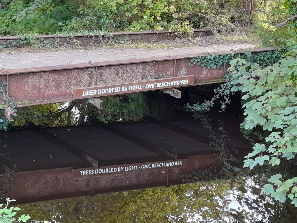
” Trees doubled by light – Oak, Beech and Ash” – reflected in the water. Picture courtesy of Stephen Fryer
The four-and-a-half-mile canal, a major feat of engineering built over a period of 14 years from 1803-17, was the brainchild of John Taylor, an engineer from the huge copper mine at Wheal Friendship. A better link was needed to carry copper ore to the River Tamar, replacing the tortuous routes through narrow lanes and rough tracks.
Simon Dell guided us along part of its route from the centre of town, starting from the take-off point by the weir with its ingenious leaf clearer in action as we passed. We followed the route through the car park, originally the first wharf built over the former Abbey’s kitchen gardens and past the Guide Hall (the old grain store) where the canal flows underneath. On the next wharf, a series of buildings include the old Company offices, a coal store (now the Wharf Arts Centre), a limestone store (lime kilns were adjacent to the river) and the remains of the double wharf with swing bridge.
Passing through the meadows, a gift from the Duke of Bedford, Simon explained how the Fitzford cottages were built for the mining labourers in the town. He said how much of the early route traced the line of the Crowndale leat, passing now behind the College through the Woodland Trust woods, on a gentle gradient which facilitated the operation of 12 waterwheels along the way. Wrought iron boats were built locally and pulled by horses along the canal, 1 required for the downstream and 2 up against the flow. What is thought to be an old barge tiller has been found in the canal. Remains of quarries can be seen by the side walls.
We concluded our walk at Crowndale Farm and Wharf alongside the old storage building and the bridge with words “writ in water”. A poetry trail created by the local College students has followed us along the way. The towpath passes under the bridge along with blue copper staining on the walls. Further on the canal passes through the Morwell Down tunnel, an incredible engineering feat in itself, nearly 2 miles long, 500 feet deep through Wheal Crebor copper mine and on to Morwellham.
In 1933, the canal was purchased by the local electricity company which then built a hydro-electric power plant at Morwellham. Now owned by South West Water, it continues to feed power to the national Grid.
Simon’s knowledge, enthusiasm and entertaining discourse made for a very enjoyable evening. An extended and circular walk can be followed to Lumburn and Mill Hill, though unfortunately access to the tunnel is now in private ownership.
An historical stroll around Horndon and Zoar
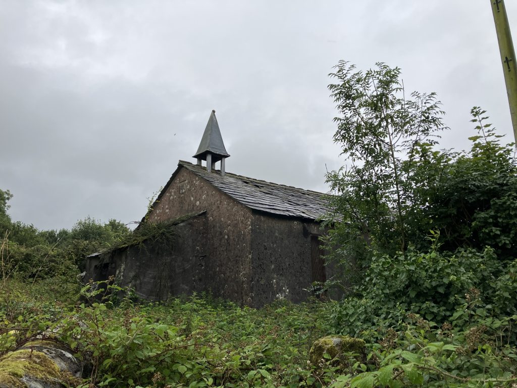
St. Joseph’s – picture courtesy of Alison Blackwell.
Brentor Church peeped out of the clouds as the thick mist and rain cleared just in time for our walk around these historic hamlets, led by Jill Borrow and assisted by Roger Kingdon. Starting at the 1904 Bible Christian Chapel, we walked up to the open Common. On the way, Jill explained how the area grew up from “Miners Town”, in the boom years of the 1800’s. Workers and their families arrived from all over and the population expanded with the exploitation of the copper and later arsenic industries, especially from the nearby huge Wheal Friendship. Small farm agriculture also spread and several cottages were built around Zoar Common. (the name Zoar believed to mean “place of shelter or refuge†from the Bible).
Our first stop was at the impressive “Preacher’s Rock”. Here, the Cornishman Billy Bray, a reformed degenerate and drunkard, became famous for his charismatic services, travelling widely and preaching to huge crowds and raising funds to build chapels. One from c1832 is now the home of Roger and shows little signs of its origins which had a congregation of c50 and a stable for the preache’™s pony. A recent restoration has, however, revealed an original arched window.
We continued back past an old miners’ loading platform and the original Black Lion pub. The 1904 chapel was built with funds raised from the local congregation and miners whose initials can be seen on stones. The deteriorating building closed in 2009, is now in private ownership awaiting potential conversion – the old organ disintegrating outside, a sad reminder of its past.
Further down the road is the even more ruinous St. Joseph’s Chapel of Ease, built around 1844, closed in 1961, now used as barn storage. It was called at times the a “Slum Church” and was used for whist drives, parties and meetings. Our final stop was at the Wesleyan chapel 1836-90, also used now as a barn. Up until several years ago, it was reported to still have wall paintings visible which is extremely unusual for a chapel of this type. It is also thought to have been used as a schoolhouse after it was no longer a chapel.
Incidentally, Jill told us that the Elephant’s Nest Inn (now a guest house) was originally the New Inn, possibly named so, after the original drinking house further up the road had closed.
A fascinating look at this small community built on mining and its associated religions.
A walk around the old silver mines at Weir Quay
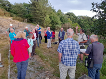
The group at South Tamar Consols (picture courtesy of Stephen Fryer)
Clive Charlton led the group on a circular stroll around this old mining area. We started at the South Tamar Consols mine which was the final operation on the important lead-silver lode running through the Bere Peninsula. The lode was exploited again during the medieval period, when the Crown organised and controlled the celebrated Bere silver mining industry. For around seventy years, various mining enterprises operated on the lode, with a series of shafts sunk and changes in ownership and name.
By 1854, South Tamar Consols was employing over 300 persons (some were women) and produced 840 tons of lead and 60,689 ounces of silver. Its workings went down to the 720 feet level, extending south beneath the Tamar but suffered a disastrous flooding from the river in 1856. A weak slide or fault under the river suddenly gave way but as it was Sunday there were no miners at work, and hence no casualties. However, the mine never reopened; the company was wound up and the surface equipment auctioned off. Many local people lost their livelihoods – and many emigrated.
Next, on to the Tamar Smelting Works which was probably established in the 1820s to smelt the ore from recently developed shafts above Weir Quay. The main output was lead, with silver as a valuable by-product. The celebrated metallurgist, mine manager and engineer, Percival Norton Johnson took control and introduced new smelting techniques to cope with the expanded output of ore from the mines on the Peninsula. In addition, some ores were imported. The premises then became, famously, a jam factory and later workshops and stores before partial conversion to residential use.
Clive recalled how the market boats (paddle steamers) operated a regular service on the Tamar from around the 1840s, going from Calstock to Devonport, many of the passengers heading for Devonport Market. Although a market boat service appears to have continued after WW1 (with a motorboat in use until the early 1930s), the great days of the paddle-steamers was over and of course, the railway had come to the Tamar Valley.
The large building at Hole’s Hole was an inn by 1850 and had various guises, including the”Cross Oars” and latterly the “Tamar Hotel”. It became the “Tamar View” hotel by 1919 but was a private residence by around 1924.
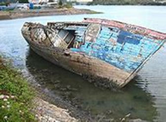
The wreck of the Merganser is prominent in the landscape at Holes’ Hole. Launched in 1887 at Gosport, she was initially a single-masted cutter and rather unusual, as she was designed and operated as a ˜trawling yacht”, but with more elegant accommodation so she could also be sailed for pleasure. In 1906 her rig was altered to that of a ketch. She was beached at her present position and converted to a houseboat with new living quarters on the deck before WW2. In 1947, it was bought by the Hall family, who lived aboard until the early 1970s.
The walk concluded with a circuit around Hewton and then old miners’ row of Cotts.
“HMS Amethyst and the wrecks of Plymouth Sound”
Mallory Haas is a marine archaeologist working on the Ships Project CIC which is a volunteer organisation that undertakes research and exploration of marine historical sites and events, both on land and underwater and is based in Plymouth. Mallory told us that the work of the project is undertaken by volunteers and it became a Community Interest Company (CIC) in 2021 which is a special type of limited company which exists to benefit the community and not shareholders and is funded by donations. Their work includes researching ships and searching for wrecks, recording and mapping new wrecks, talks to clubs and societies, and training divers for underwater archaeology fieldwork.
Mallory told us that geophysical surveys have been done to look for wrecks: do the science first and then go diving! Shipwrecks rarely get discovered; 120 hulks have been found but records said that there were only two. Mallory showed a map of the shipwrecks in Plymouth of which some were intentionally sunk. 650 people were lost on RN Coronation in 1691. The Amphion was destroyed by fire in 1796 with a big loss of life – 278 people died as there were lots of officers and their families on board due to a farewell dinner being in progress. HMS Pallas was wrecked in 1798 in a storm off Jennycliff.
The last one identified was HMS Amethyst, found 7 years ago. She was launched in 1799 but by 1811 had sunk in the Sound and lay undiscovered until July 2013. The ship was a 36-gun RN frigate and in February 1811 she was due to leave Plymouth Sound after the crew had finished repairs. The captain needed to go ashore so issued instructions to the crew to recover one of the 2 anchors that was holding the ship so she could leave quickly on the captain’s return. When he returned to the ship, he did not give orders to sail or order a second anchor to be dropped below. During the night, gale force winds rocked the ship and, with just 1 anchor, was blown to the shore. The ship’s cannons were fired as a distress signal and people on the beach fixed rope between ship and shore to allow crew to escape. By morning, the ship was stuck on the rocks and had to have guns and stores removed to lighten the load but to no avail. Another storm caused the HMS Amethyst to break up and she soon sank. The captain, Jacob Walton, was court martialled and severely reprimanded over the loss.
A geophysical survey was done to discover the wreck and over 5000 objects were found: cannon balls, ship fittings and timbers were found partially buried in the muddy seabed and hidden by thick seaweed. Copper sheeting and bolts were discovered, the sheeting had crows’ feet printed on it to prevent it being stolen, and thousands of sheeting tacks. Work is still ongoing and discoveries being made.
“The History of Turnchapel”
With his mixture of humour and beautiful old images, Robin Blythe-Lord provided an entertaining history of this ancient site on a hill beside the Cattewater in Plymouth. He explained how the origin of the name could have been from “tan” meaning fire (from smelting) and the use of chapel from the nearby one at Lower Hugh (Hooe).
There was no trace of a settlement on the map in 1724 and it was not until the mid-19th century that the shipbuilding and repair yards opened up in the area with their wharves and dry docks, established with the help of Lord Morley. Close by, the exploitation of the huge limestone quarries also became a feature as the area started to become more industrialised. Access was mainly by boat or the long way around the hill.
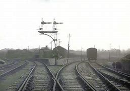
A railway was then constructed running through from sawmills at Oreston, via a swing bridge over Hooe Lake and connecting to Hooe Point by a tunnel underneath the village. A 1924 image of the train and bridge brought this scene to life. Timber was floated upstream, hauled out, dried and creosoted ready for use in the shipyards. The railway continued in use until the 1960’s.
As the quarries opened up, lime kilns were built for the crushing of the stone, including a unique gas kiln which produced no coal dust. Ochre was also recovered from the quarries for use in making brown paper. High fatality rates accompanied the working and there are still signs today of worker’s hammer marks in the rocks. Ponies were used in the transport of materials to the barges. Bones have since been found in the numerous caves including those of wild boar, rhino and human! Although this area has now been developed for housing, remains can still be found of the old roads and railway.
A public quay was built with a ferry, over which there many disputes over the fares. Pilotage also became a competitive affair with the fastest boats gaining the advantage. A bit of smuggling was not unheard of during the process. The appearance of seaplanes in WW1 involved the Air Ministry who had their own railway siding, and a gas pound and oil storage tanks were built.
The village suffered from bomb damage in WW2 and the area is now much changed from its industrial beginnings after regeneration activity with a large marina built and most of the quarries disappeared under housing. The village has lost most of its nine shops, five of its six pubs, and the Infants School. However, Carnival Cave functions like a village hall with various social events. Robin’s superb photo images of old and new highlighted these changes in his fascinating exploration of Turnchapel’s history.
William the Conqueror 1066- 1087 (a talk by Alan Bricknell)
With Harold and his brothers lying dead on the field of battle, the English army dissolved into flight. As William celebrated, the Anglo-Saxon ruling Witan gathered, panic-stricken, in London and argued amongst themselves. Some wanted Edgar the Aetheling aged 14 to be chosen as King, Others, in opposition to the Witan argued that Harold’s defeat was a sign of God’s displeasure and a punishment for sin. They also wanted a strong king as soon as possible who would guarantee their possession of Church estates. But, no Englishmen of any repute had yet submitted to William, and he grew impatient.
He began by taking reprisals against the men of Romney who had attacked his ships, sacking towns along the coast and continued to ravage around the countryside until London finally surrendered and he was crowned as King on Christmas Day 1066. A period of calm came ahead of the storm.
William promised to be a gracious lord to the English, but took the view that England was now his to do with what he wished. He introduced a new tax with the penalties of non-payment being forfeiture of estate, along with new laws to try to control the locals, many of whom viewed him as nothing more than a tyrant, and soon land began to be transferred to the Normans as revenge for earlier resistance.
Rebellions started in the north, not long after William had left for Normandy and quickly spread to all areas of the country including Exeter which was heavily fortified. After his return these were quelled and his wife, Matilda was crowned queen. However, the coronation was almost immediately followed by a series of more serious rebellions which threatened to disrupt his control over the kingdom.
Rising discontent about the injustices of Norman rule re-surfaced in the north. At the same time appeals were made to Swein of Denmark to claim the throne of his ancestors. William was caught between his policy of promoting Englishmen and his need to satisfy his most powerful Norman supporters and now took firm military action putting down further uprisings in York and the southwest and incursions by the Danes. His loyal commanders were often left in charge employing ruthless tactics, and the English risings were uncoordinated and ill-planned. They had no charismatic leader to pull the resistance together. William continued building a chain of royal castles which discouraged resistance.
He then decided to recoup the cost of his campaigns against the English by confiscating the remaining wealth of the rebels and set about accomplishing his final solution to the Northumbrian problem – the Harrowing of the North, succumbing to the urge for cruelty, making no attempt to restrain the brutality of his men. They were allowed to harry the land, turning homes and farms to ashes, producing famine and desolate wasteland. Crops, herds, chattels and foods of every kind were destroyed, along with many thousands of lives.
Over the following years, problems increased for William as resistance continued. Endless battles were fought. The Danes returned on Ely, King Malcolm of Scotland carried out raids and problems arose in William’s native Normandy. By 1074 most of his opponents including Edgar Aetheling began to act in concert. Even the earls of Brittany became involved. Further campaigns were required by William and his men at home and abroad to deal with claims for control, often ending with violent conclusions.
It was on one such offensive through France that William was thrown off his horse, sustaining serious injuries. He died soon after in 1087 and more chaos followed.…….
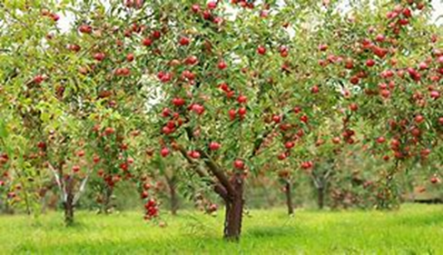
“Devon’s Orchards: how we took to cider”
Michael Gee explained how even though Devon and the rest of the west country is famous, China is the world’s biggest producer of apples and France the leaders in cider making. Apples originated from China via the Silk Road and Greece in the early days had extensive orchards favoured by the Romans. It was probably the Normans who introduced orchards to areas such as Kent and Herefordshire.
Earliest records appear in 1297 where cider featured as a payment by tithe. Orchards were created by the monks and at that time cider was seen as a special drink, rare and expensive. By the time of the Reformation and civilised courts, foods became more refined and fruit became popular. Nurserymen were employed taking over the management of monasteries and their orchards. Trading in fish, fruit and wine with the US also took off encouraging more commercial orchards. Following comments by the constitutionalist John Hooker in the 16th century that beer was an habitual vile ale, cider was seen as a better drink, encouraging more orchards.
A survey of cider orchards and production was carried out in 1757 by the Dean of Exeter. Although Meavy’s return featured “very few and very little”, there was a big return from Modbury of 100k gallons. Interestingly, a 1786 diary listed apple varieties, many of which are still around today. As new more sophisticated equipment was introduced, more and more larger producers came on to the scene, including Hunts of Paignton, in business since 1805. Whiteways was another Devon based company until 1985 with its successful advertising of “cyder” as a healthy drink. An unsuccessful move to introduce a cider tax in 1763 led to protest riots. The industry also overcame Devonshire colic, an ailment said to be associated with cider drinking, by the removal of lead in the production process.
However, by the Napoleonic war period there was a big emphasis on increasing agriculture with a change of use to arable. This led to a slow decline in orchards. This continued with increasing urbanisation, mechanisation and the move in the Truck Acts to pay wages instead of by goods in kind. Attitudes to alcohol changed too with the advance of Methodism.
By the 1990’s a huge revival was taking place. Contract planting of new orchards and new producers, including the very successful Sandfords of Crediton and craft cider makers with small scale equipment came on the scene. The Common Ground campaign was formed to save orchards. Community orchards and apple day pressings and festivals like wassailing have become popular, new advice organisations have been set up. Orchards have become recognised as good for wildlife. Cider is now a trendy drink with all sorts of fruit varieties.
Devon with its challenging climate of wind, warmth and wet leading to canker has had as its own fruit, the mazzard , a domesticated form of wild cherry. Grown extensively mainly around the Taw valley in North Devon, it suffered similar declines to other orchards. A campaign was started in the 1970’s at Landkey and a local nurseryman has started growing them again. The future of orchards looks brighter than for some time.
Conquering the Dumnonii: new light on the Roman Army deployment in Southwest Britain.
Dr. Chris Smart, who had been instrumental in the excavation of the Roman fort project at Calstock, returned to tell us of his most recent research following a 2017 National Lottery grant. With little evidence before his latest project on the existence of Roman activity west of Exeter, he explained how the grant had facilitated the use of new technology such as LIDAR to shed new light on the period of occupation.
Over 500 archaeological sites in Devon and Cornwall have now been mapped, ranging from the Neolithic age to the 18th century, many of which appear to be associated with Roman activity, including a network of roads from the Quantocks through to West Cornwall. Some of these seem to lead to settlements at road junctions, mining areas and a possible old fort on the River Parrett at Bridgewater. There is also a suggestion of ridge routes between Lifton and Sourton.
On Roborough Down between the two leats there is evidence of an early road and some Claudian coins have been found in the past at South Brent, Sherford and Cornwood. The recent A30 road improvements uncovered lines of pits and constructions made of soil and stones (known as agger); also at Restormel castle.
Among the questions posed by Dr. Smart was – were these military roads or post settlement ie. civilian routes? Also, were they used to link marching camps when the legions were on campaign or did they lead to other forts, ports or urban sites? One set of images near North Tawton suggests an over-wintering settlement with its own amphitheatre. Near Lapford in Devon there is evidence of an auxiliary fort above the River Yeo and the site of a defended town. Other images exposed by LIDAR with various buildings suggest urban areas.
Among other areas highlighted by the new data are sites in the Fowey valley, overlooking an historic river crossing, a small garrison near Roche and camps near Bishops Tawton (similar layout to Calstock) and Exbourne. Dr. Smart also suggested that there may have been two distinct phases of road and fort building, before and after major local uprisings.
What is certainly clear from the evidence found so far from the recent research, is that the idea that the Roman influence did not extend beyond Exeter (Isca) is no longer valid. The maps show many other signs of ancient roads, forts and settlements and there is clearly lots more to be discovered on this fascinating topic.